Image:Yukon.png
Un article de 366 Jours par An.
Pas de plus haute résolution disponible.
Yukon.png (280 × 230 pixels, taille du fichier : 15 ko, type MIME : image/png)
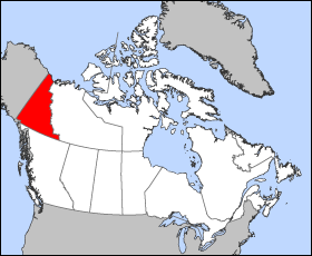
- Map of the Yukon Territory
- Projection: Lambert azimuthal equal-area
- Geospatial data from: The Atlas of Canada, The National Atlas of the United States and U.S. Geological Survey
- Cartographer: John Fowler
|

This photographic reproduction is therefore also in the public domain.
Historique du fichier
Cliquer sur une date et une heure pour voir le fichier tel qu’il était à ce moment-là
| Date et heure | Utilisateur | Dimensions | Taille du fichier | Commentaire | |
|---|---|---|---|---|---|
| (actuel) | 28 février 2008 à 13:44 | Ephemeride (Discuter | Contributions) | 280×230 | 15 ko | {{WC}} * Map of the Yukon Territory * Projection: Lambert azimuthal equal-area * Geospatial data from: The Atlas of Canada, The National Atlas of the United States and U.S. Geological Survey * Cartographer: John Fowler {{PD}} |
- Modifier ce fichier en utilisant un application externe
Voir les instructions pour plus d’informations.
Pages contenant l’image
Les pages ci-dessous contiennent cette image :
